4.20 Line-snapping settings
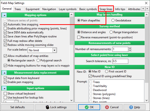
You have to turn on a function "Automatic line snapping" for access to tab "Snap lines" in the settings
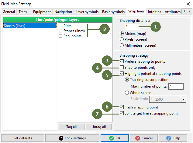
- Snapping distance
This distance can be defined in meters (map units) or in pixels or millimeters (screen units). If the overshoots or undershoots are in defined snapping distance, undershoots are automatically snap and overshoots are deleted.
- Line, point and polygon layers
Enables / disables line, point and polygonal layers for snapping. New lines will be snapped to the closest line of selected layers.
- Prefer snapping to points
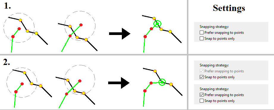
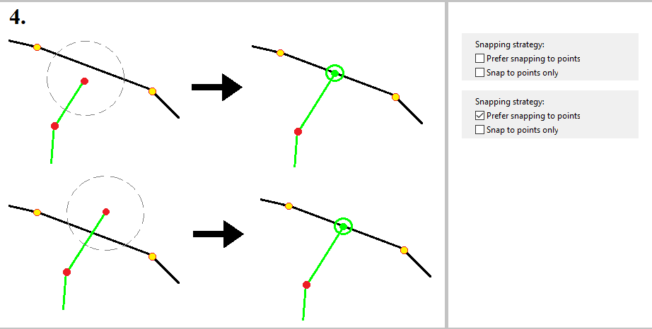
The function is enabled: The line is snapped to the closest point (figure 2). If there is not any point within the snapping distance (line vertex) the line is snapped perpendicularly to the nearest line (figure 4). Note: It is possible snap to the segments.
The function is disabled: The line is snapped to the closest line (figure 1 and 4).
- Snap to points only
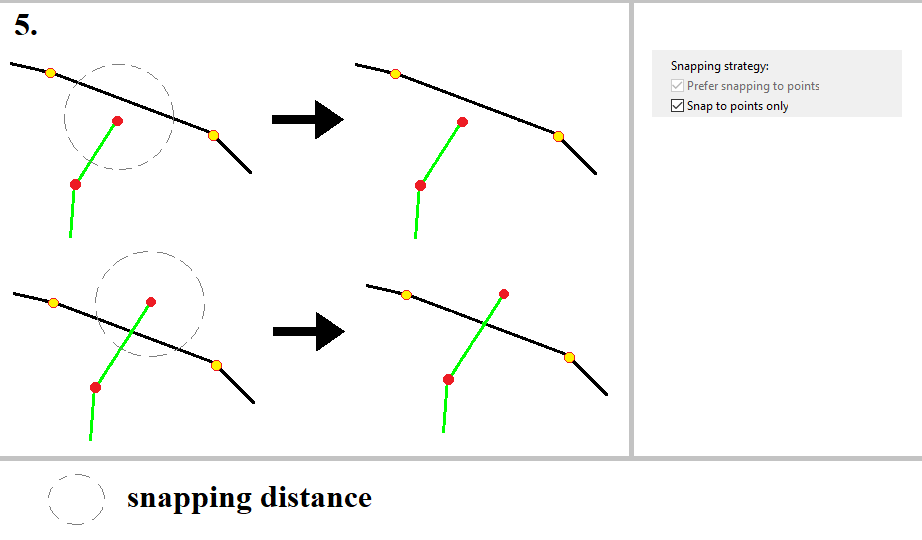
The function is enabled: The line is snapped only to the points (line vertices), if there is not any point within snapping distance the snapping is not performed (figure 3 and 5). Automatically is enabled a function Prefer snapping to points.
The function is disabled: The line is snapped to the closest point or to the closest line.
- Highlight potential snapping points
Tracking cursor position - when is this function enabled you can set a Max number of points. It means you can see on the map a X highlighted potential snapping points, around your cursor. Where X is the Max number of points.
Whole screen - when is this function enabled you can set a Scale limit. Then you can see on the map in the scale limit a highlighted potential snapping points.
- Flash snapping point
Switch ON/OFF flashing of snapping point.
- Split target line at snapping point
Sets whether to split the line in the position of snapped point into two objects.
Example snapping strategy
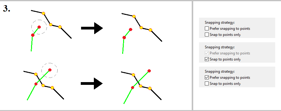
Even if there is no snapping strategy selected, Field-Map is trying to prefer points anyway (if there are close enough)