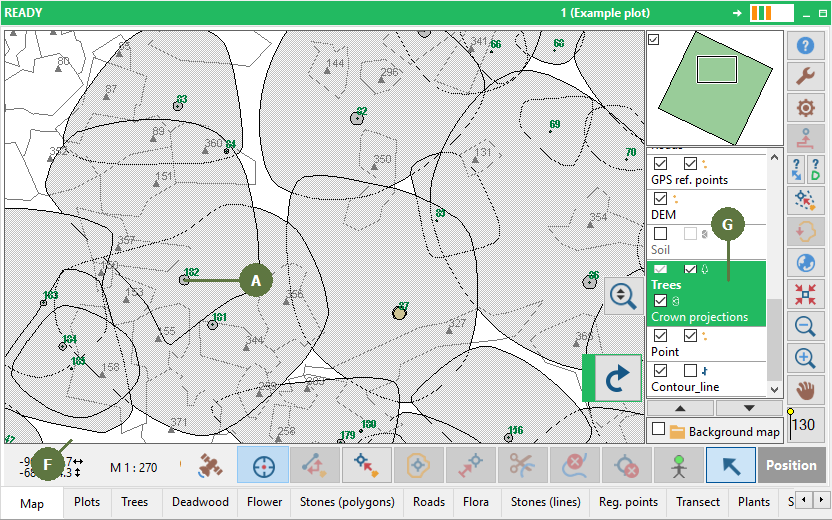
Field-Map Data Collector maintains an active relation between the map and the attribute table. Selecting an entity in the map also selects the appropriate record in attribute table and vice versa.
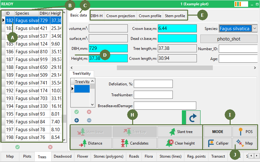
The List of measured trees is used for selecting trees.
The Overview field is useful for showing important attributes for all measured trees.
Descriptive attributes of a selected tree are listed in column in the same order they were defined in Field-Map Project Manager.
Special forms for measuring horizontal crown projection, vertical crown profile and stem profile as well as DBH-H relation graph are accessible by clicking on the appropriate tab.
The Map is used for viewing the position of measured trees. You can also select trees by clicking on a tree point in the map.
To activate the tree layer, click or doubleclick on its label in the Layer list. An active layer is highlighted green.
Buttons for tree height and crown parameters measurement. The appearance of this panel changes depending on the selected tree height measuring mode and on the Settings / Trees - live, dead and slant buttons.
Buttons for choosing the tree height measuring mode and downloading data from calliper and positioning .
Map a new tree button that enables mapping a new tree without switching to the map form.