3.3 Establishing new circular plots
|
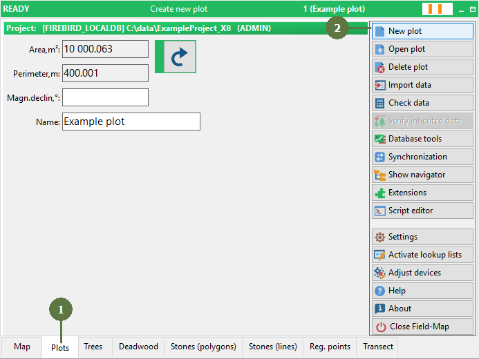
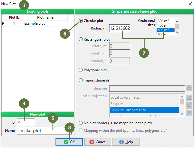
When the project is opened for the first time and no plot has been established yet (empty project), Field-Map Data Collector automatically prompts you for to establish a new plot by displaying “New Plot” dialog box. Size of the circular plot You may choose the area from a list of predefined plot sizes or enter a desired radius in the Radius edit box. |
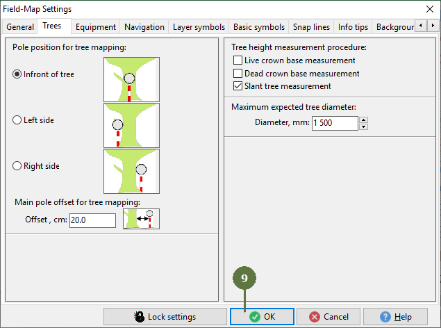
9. A dialog box Settings appears. Check the pole position for mapping option. Click OK
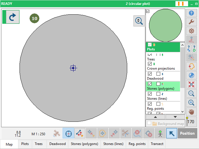
Note: You will be asked to fill magnetic declination value before approving creation of new circular plot. For explanation about settings see Settings 10. A map of new circular plot appears
|