|
Editing the border polygon
The plot boundary remains editable. After editing the plot boundary it is necessary to close the polygon manually by clicking on Close Polygons button. Field-Map Data Collector recalculates the area and perimeter attributes of the plot.
|
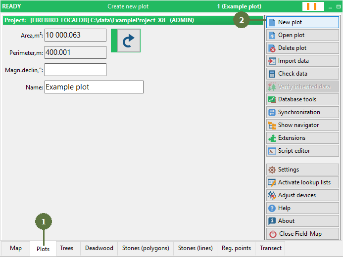
- Switch to the Plots form
- Click the New plot button
- Type ID into “ID” edit box
- Enter a name into the “Name” edit box
- Click the Rectangular plot radio button
- Enter the width of the plot into “Width” edit box
- Enter the length of the plot into “Length” edit box
- Optionally set the rotation of the plot into “Rotation” edit box
- Click OK

- Map of a new rectangular plot appears

|