13.11 The principle of concentric circles
|
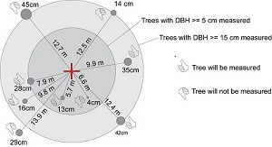
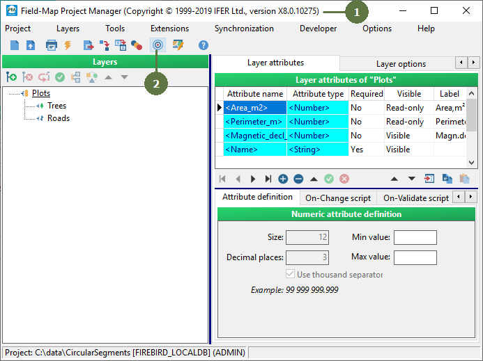
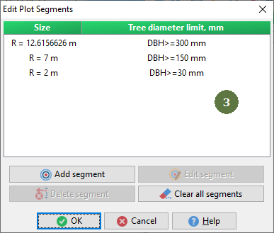
The configuration of concentric circles is a specific feature frequently used in forest inventory programmes. Usually there are tree diameter limits set for various radiuses of concentric circles. In the outer part of the plot only large trees are measured, and towards the centre of the plot the diameter limit decreases. To fulfill this particular methodological requirement, Field-Map enables you to define radius of concentric circles and related diameter limits. This can be done using Field-Map Project Manager. In the field, Field-Map checks the radius and the tree diameter and warns you if a tree smaller than prescribed limits is being measured.. |
The principle of concentric circles is available only for circular plots (see also “Single sized circular plots”).
A Trees with DBH > 50 mm are measured within a circle with a radius 8 m. B Trees with DBH > 150 mm are measured within a circle with radius 12.616 m (entire plot). Setting in Project Manager For more information see in the Project Manager user guide.
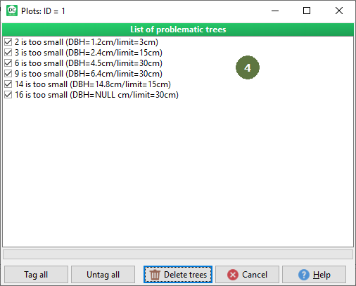
This window will appear also if you check a data, see chapter Validating database content.
|