18.2 Navigation to a selected point using GPS
|
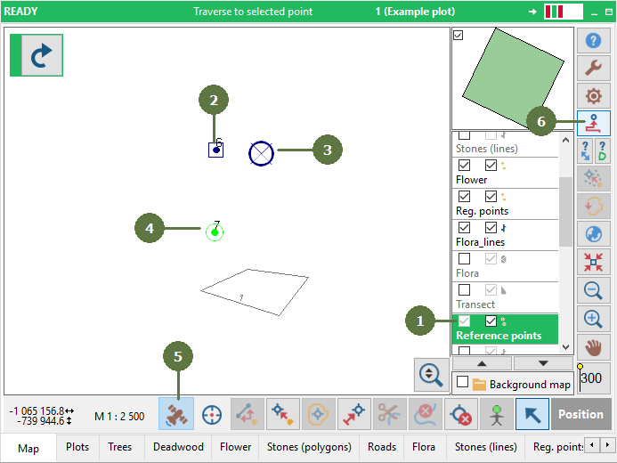
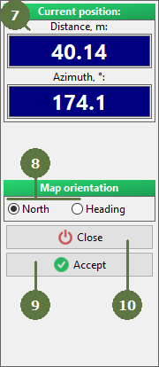
Display your position in map anytime Set GPS to a unique COM port and your position in the map window will be visible anytime (applicable for plots in a global coordinate system). Any Bluetooth GPS receivers or receivers with a serial cable supporting NMEA output protocol can be used. This function doesn't require any special activation. Map orientation It is possible to choose the map orientation during the GPS navigation. The map orientation can be fixed to the north or it can be automatically changed according to the direction of the working direction. |
Blue cross indicates your position
|