4.8 Trees settings
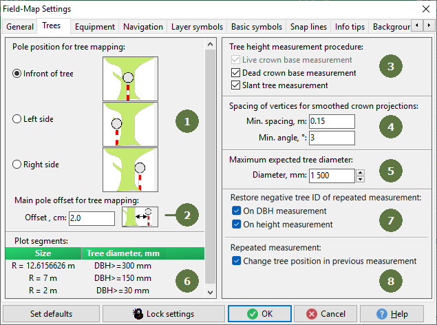
- Pole position for tree mapping
You can choose the pole position for tree mapping. The measurement procedure is the same for all three options.
- Main pole offset for tree mapping
Enter the main pole offset.
- Tree height measurement procedure
Tagging appropriate check boxes allows user to determine if the tree crown parameters is measured (tree height, live crown base, dead crown base, slant tree).
If you tag all options, then the corresponding buttons will appears in the Tree layer

- Spacing of vertices for smoothed crown projection
Enter the spacing of vertices in meters and angles.
Note: this function is available only for a tree layer with crown projection, for more information see to the Project Manager user guide
- Maximum expected tree diameter
Field-Map Data Collector sets the virtual concentric circle close to the plot border (depending on expected tree diameter). When a measured tree falls outside of this circle, Field-Map Data Collector will ask the operator about its diameter in order to accept or reject tree.
- Plot segments
Size: Size of the segment.
Tree diameter: Minimal accepted tree diameter within a specified sub-circle
You can increase efficiency by not measuring all the trees in the plot. Instead you can do detailed measurement in the inner circle and less detailed measurement in the rest of the plot (see picture below).
Note: this function is available only for plots with circular segments, see chapter The principle of concentric circles
- Restore negative tree ID on repeated measurement
In projects with repeated tree measurements where the tree ID was set to negative when copying the tree layer (in FM Project Manager),
the negative ID will be changed to positive automatically when the DBH or height is re-measured.
- Change tree position in previous measurement
In projects with repeated tree measurements, you can automatically change the coordinates in the previous layer when you change the position of the tree.
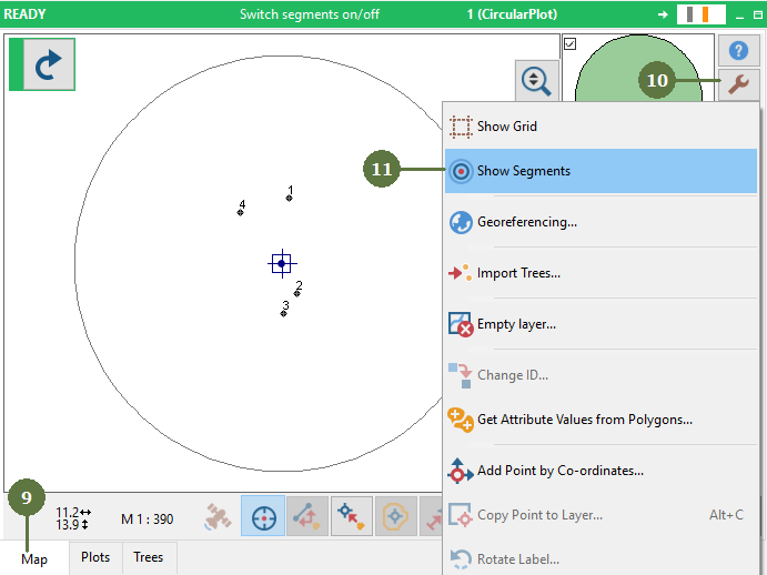
Show Segments
- Switch to the map form
- Click the Tools button
- Select Show Segments
- The circular segments are visible
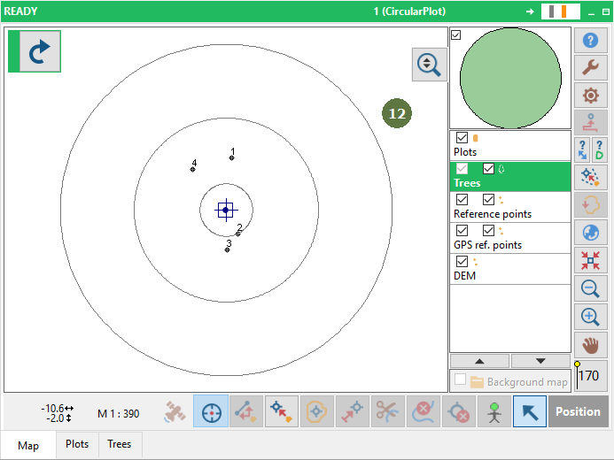
Note: To hide the segments, Click Tools button and select Hide Segments
The principle of concentric circles

Note:
Segments can have any shapes. (see chapter Segments in Field-Map Project Manager Manual)